The Storå Valley
From outwash plain to postglacial river valley.
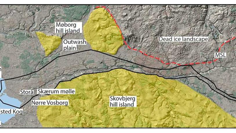
Figure 21-1: Map of Storå valley that borders Skovbjerg hill island to the south.Photo:Geopark Vestjylland
This locality follows river Storå and is 38 km long and up to 4 km wide. The river flows from east to west through Holstebro and reaches Felsted Kog/Nissum Fjord in the west. The locality lies in the southern part of GPWJ and south of the MSL in an area dominated by a landscape from the Middle Weichselian or Saalian (hill islands) and outwash plains from the Late Weichselian (Figure 21-1). The locality is part of a large east-west trending outwash plain that connects the extensive heathlands of Karup Hedeslette in the east with Felsted Kog/Nissum Fjord in the west. The hill island at Skovbjerg lies to the south and to the north are the younger glacial landscape and small hill islands at Møborg (site 25) and Linde (site 26).
The locality is a good example of an outwash plain that was the major route for meltwater when the Scandinavian Ice Sheet stood as its maximum position 23.000-21.000 years ago. The outwash plain consists of meltwater sand and gravel and forms a plane surface that slopes gently down to the west. The plane surface is cut by the postglacial valley in which river Storå flows, as well as by several small water-eroded tributary valleys.
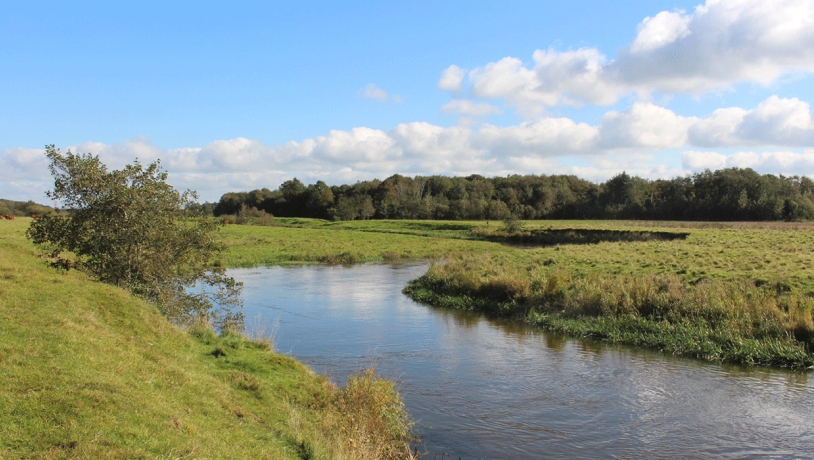
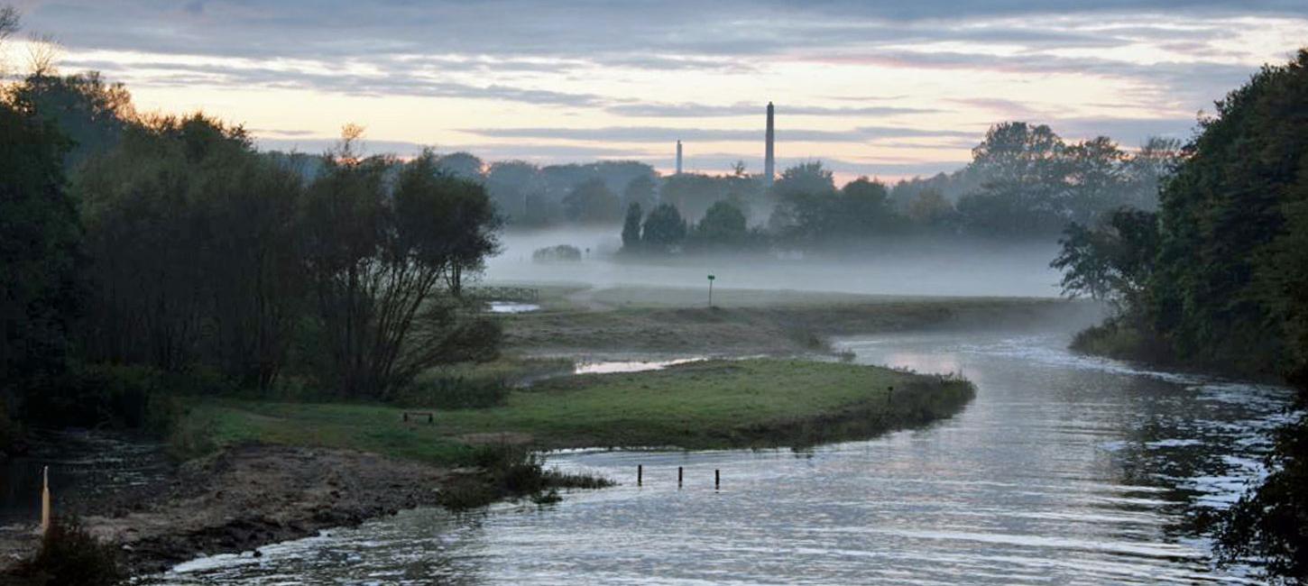
Photo:Geopark Vestjylland
The flat outwash plain was formed by deposits from meltwater that flowed from the heathland areas in the east (including Karup Hedeslette and Sønderhede - site 5) and on its way to the sea was forced into a passage between the ice-covered area and small hill islands to the north and Skovbjerg hill island to the south. The meltwater locally eroded into the hill islands (e.g. at Burlund – site 24) (Figure 21-2, 21-3). The outwash plain was the main route for meltwater from the Karup heathland (see also site 16 - Stubbergård Sø – Flyndersø) until the meltwater was able to flow northwards through the Karup valley system to bay Venø Bugt in Limfjord (site 28).
This change in the drainage pattern combined with isostatic uplift of the area forced the meltwater to erode down into the Karup outwash plain, thereby forming the current Storå river valley. The postglacial valley cuts up to 10 m down into the pre-existing valley floor. Most of the water in river Storå now comes from tributaries flowing from Skovbjerg hill island in the south and from parts of Karup heathland in the east (e.g. river Idom Å - site 35).
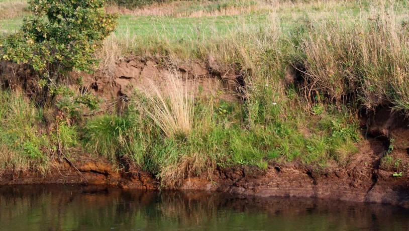
Photo:Geopark Vestjylland
In the upper stretches of river Storå, weathering of iron-bearing minerals washed out of the moraine deposits has led to the formation of bog iron ore. The many water courses and small meadowland areas are protected under Nature Conservancy Law § 3 (protected types of nature). The area where river Storå flows into Felsted Kog/Nissum Fjord is a Natura 2000 site and Ramsar area.
The low-lying meadowlands have long provided important grazing areas for horses that form the basis for horse breeding and trading at large farms like Nørre Vosborg. Bog iron ore has been exploited for iron ore and building stones. Possibilities for recreation in the area include angling, canoeing and various activities at the Folkeuniversitet (Open University) at Skærum Mølle.