Linde Hill Island – Sir Lyngbjerg
Part of a hill island in connection with the moraine landscape behind the MSL.
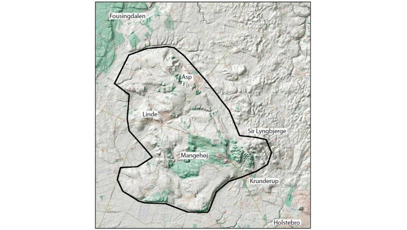
Figure 26-1: Linde hill island is clearly delimited by the Fousingdalen valley and the Storå outwash plain, and to the north by the Kilen outwash fan. Its boundary with the MSL and the moraine landscape behind this line is more diffuse. The hilly area east of Sir Lyngbjerge is included since it is part of the larger entity. Photo:Geopark Vestjylland
Linde Hill Island is really a “peninsula”, since it concerns an elevated landscape from the Middle Weichselian or Saalian glaciation outside the north-south curvature of the MSL from the Kilen tunnel valley to the area south of Sir Lyngbjerge about 5 km northeast of Holstebro. To the west it is adjacent to the Klosterhede outwash plain and the Fousingdal Valley (sites 20 and 23), and to the south the area is limited by the marked erosional cliffs on the south side of the Storå Valley (site 21). The landscape comprises a range of gentle hills that extend NW-SE which are considered to represent glacial landscapes from the Middle Weichselian or the Saalian glaciation since they have been smoothed by periglacial processes. The northern eastern flank of the range of hills is cut by a series of erosional valleys that extend down to a parallel valley. The southern end comprises the hilly landscape at Sir Lyngbjerge. The hill island occurs in two municipalities - Struer and Holstebro. Sir Lyngbjerge is located in Holstebro municipality (Figure 26-1).
The MSL in Jutland extends east-west from Bovbjerg in the west to Skelhøje near Viborg in the east where it turns south and continues almost straight south through eastern Jutland. Along the east-west section through the geopark the MSL is usually apparent both in the landscape and on maps of soil types. Along the north-south section outside the geopark area the MSL is more diffuse and less apparent. It can commonly only be detected by comparison of the types of soil. This reveals an embayed, irregular course between clayey till to the east and meltwater sediments to the west. There is no clear topographic indication of the MSL. The large areas of meltwater sand and gravel on the hill island are assumed to represent late glacial extra marginal deposits. The many small enclaves of clayey till (about 20) are presumed to represent glacial sediments from the Middle Weichselian or Saalian (Figure 26-3).
Sir Lyngbjerge is a complex hilly landscape, presumably a terminal moraine ridge from the Middle Weichselian or Saalian glaciation that was partially over-ridden during the Late Weichselian. This has divided the hill island into two portions, an eastern one with rounded hills that was covered by ice, and a western one that is cut by several erosional valleys that were presumably formed by meltwater from the melting glacier (Figure 26-3, 26-4 and 26-5).
The main geological value of the locality is that it has features that are different from the characteristic appearance of the glacial landscape around the MSL; it contains a combination of landscape elements rather than one individual type of landscape (Figure 26-2).

Photo:Søren Raarup
There is a series of Younger Stone Age and Bronze Age barrows along the entire length of the MSL, which also was the location of an ancient road. These prehistoric features are normally located on the top of the moraine ridge, but here they are on the hill island where they follow the old moraine ridges. There are many barrows to be seen on a small area of heathland at Mangehøje plantation, just to the west of Sir Lyngbjerge, but the most interesting features here are parallel wheel tracks in the heath that beautifully show the course of the old road from Holstebro to Lemvig. The pre-historic roads and barrows are dealt with in a non-geological site.
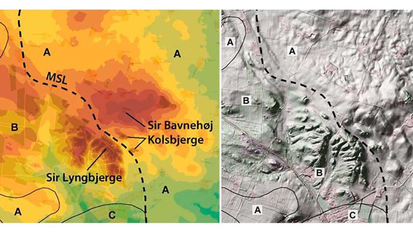
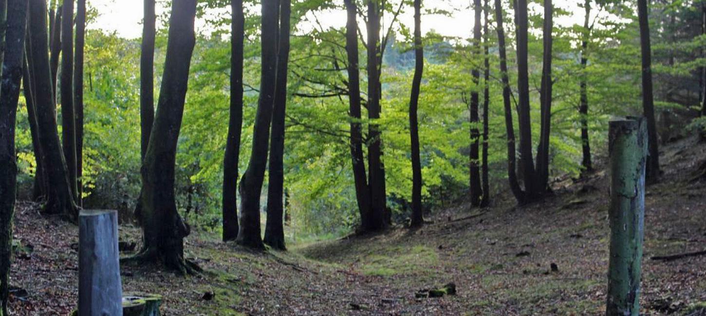
Figure 26-5. Sir Lyngbjerge with its dynamic topography is cut by marked erosional gullies. This is a very popular tourist destination for nature and leisure activities. Tall, upright beech trees are rare in western Jutland. Photo:Geopark Vestjylland
Sir Lyngbjerge used to be an important meeting place, and towards the end of the 1800´s up to 2.000 - 3.000 people assembled here for political and religious meetings. Today it is open to the public and a well-organized area for nature and leisure activities.