Burlund
Erosional cliff in the northern boundary of Skovbjerg hill island, late glacial meltwater erosion, river Storå outwash plain.
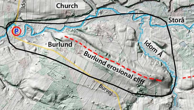
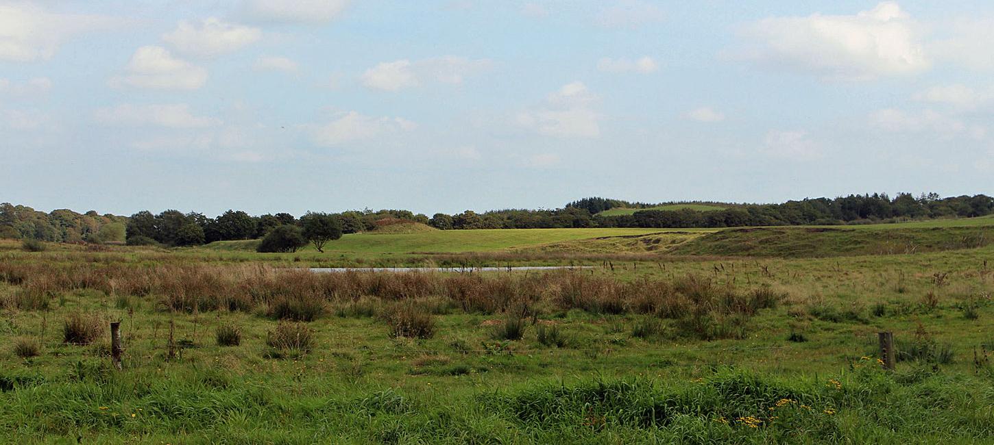
Figure 24-1. This site is named after the locality Burlund on the northern part of Skovbjerg hill island. In the Middle Ages, and probably for a long period prior to this, there was a crossing place over the river Storå on the route from the south to Lemvig, Oddesund and Thy. Photo:Geopark Vestjylland
This site, located at Bur about 10 km vest of Holstebro, comprises a roughly 3 kmlong area with a steep erosional slope between Skovbjerg hill island and the Storå river valley (Figure 24-1). The northern part of Denmark’s largest hill island at Skovbjerg has been nominated as a site of National Geological Interest (NGI 77). This comprises a total of 12 localities, 4 of which are in GPWJ. Three of them are treated in connection with site 34 (Sønder Vosborg Hede), whilst Bur is the fourth (NGI 77-7) and consists of a 3 km-long stretch along the northern boundary of the hill island towards the Storå valley. In the straight, 2 km-long interval along Idom river (site 35) the eroded surface of the hill island is particularly well developed. This was eroded by meltwater from the MSL that flowed along the northern side of Skovbjerg hill island on its way to the depression of the North Sea. This powerful erosion took place in late glacial times when meltwater from the Skelhøje/Alheden vicinity near Viborg and the Silkeborg area followed this route (see sites 21 The Storå Valley and 16 Stubbergård Sø - Flyndersø) (Figure 24-3).
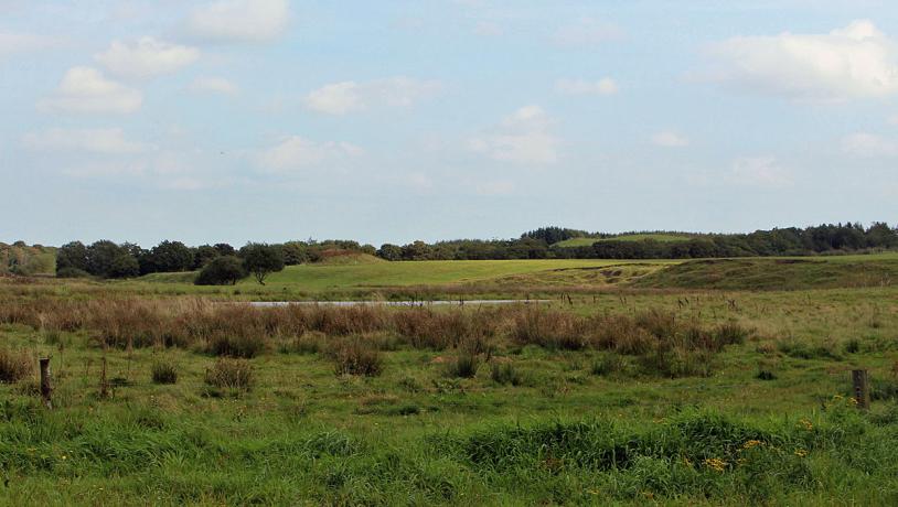
Photo:Søren Raarup
The erosional slope on the margin of the hill island lies some distance away from the river at Bur. The base of the slope is about 20 m above sea level and the slope itself is 5-7 m high. There is a plateau between this slope and the river course. The plateau consists of extramarginal meltwater sand and gravel from the Karup outwash plain from which large volumes of meltwater eroded into the northern flank of Skovbjerg hill island (Figure 24-2).
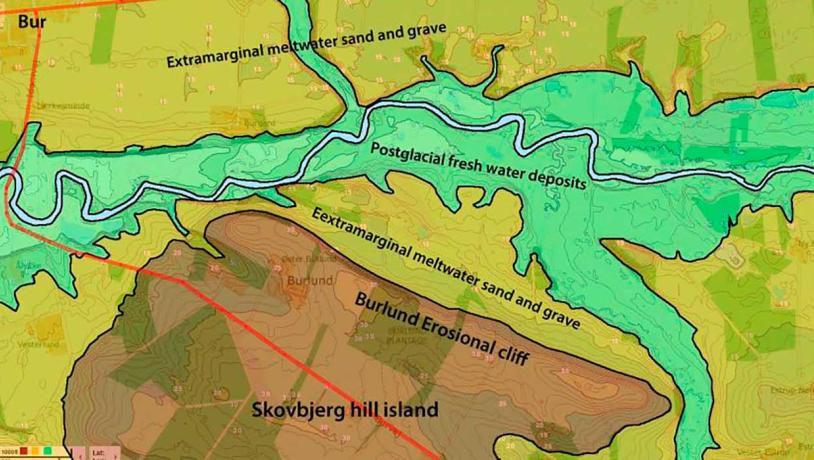
Figure 24-3. The erosional slope at Burlund where “the big river from the east” (what German geologists would call an Urstrohmtal) has eroded the northern side of Skovbjerg hill island in the narrow area between the MSL and Skovbjerg hill island during late glacial times. Photo:Geopark Vestjylland
The most obvious erosional slopes belong to a late phase of meltwater erosion when flowing water was able to erode down into deposits laid down by an earlier phase of meltwater development. There are two terasses, each of which represents a phase of meltwater activity during late glacial times. The youngest terrace has been overlain by postglacial freshwater sediments from the Storå river that also make up the present valley floor. The valley cuts down into these fresh water deposits and forms gullies that are about 1 m deep (Figure 24-4).
A public picnic place and slipway for canoes and kayaks at Bur provides an excellent location to observe the Storå valley and the erosional cliff. This is part of an extensive system of locations along the river Storå where canoes can be rented and that have facilities for camping with water, toilet, campfires and rubbish bins. River Storå contains many fish, particularly salmon, and angling is very popular. It is controlled by national and local rules that are administered by a well-organised angling club.
This site offers rich possibilities for the study of the dynamics of late glacial meltwater and the development of a postglacial valley. It is one of the few places where a road crosses a river that has a completely natural course. During the Middle Ages, the location near Bur church was important for crossing the river. This bridge became replaced by one at Holstebro, which later developed into a large town (bro = bridge).