The Ice Age Landscape
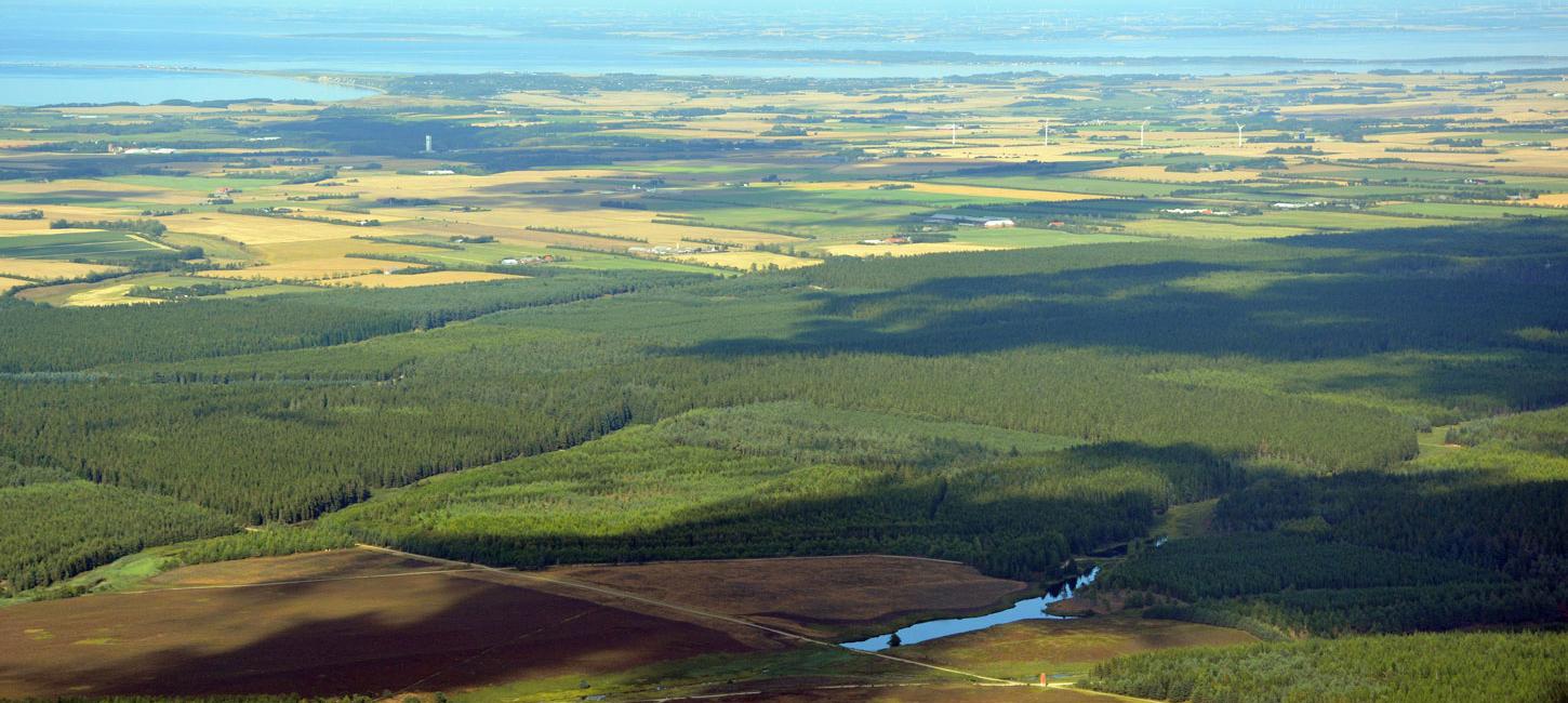
The Main Stationary Line from the last ice age forms a marked boundary in the landscape between the hilly glacial landscape and the flat outwash plains – one of the most significant landscape features in Denmark.
In the geopark the different landscape elements and their origins are highlighted and exposed. The core of Geopark West Jutland is the story of the Weichsel Ice Age, the latest in the row of ice ages. The Weichsel Ice Age is estimated to have begun approximately 115.000 years ago, when enormous ice sheets started spreading southwards from the North of Scandinavia. The Scandinavian Ice Sheet reached its maximum extent 23,000 – 21,000 years ago when most of the landscape in what is now Geopark West Jutland was formed.
Here, the ice coming from the North, was slowed down by a warmer climate, which meant, that the ice melted along a broad front as quickly as the ice sheet moved forward. This is the front today known as the Main Stationary Line. The Main Stationary Line reached from Bovbjerg in the West to Karup Å in the East and it is one of the most significant landscape elements in Denmark. While the ice covered the land to the North, the country was free from ice to the South.
The huge amounts of meltwater flowed from glacier portals along the edge of the ice and formed huge rivers and also carried large amounts of stone, gravel, sand and clay with it, which were deposited on the outwash plains to the South. The heaviest materials were deposited close to the ice edge and the lighter materials floowed further away. At the time, Denmark was connected to the present England. The ice free area was cold and the vegetation mainly consisted of low plants and different species of heather. On the outwash plains the so called hill islands rise above the surrounding plain. Around 20.000 BC. the ice started to withdraw. New periods of cold appeared and the ice moved forward once again.
The process of withdrawal and new advances over a couple of thousand years left marks that are still clear in the landscape today. Eventually, a significant rise in temperature caused the ice to melt away completely around 11.000 years ago. Bushes and trees appeared and in the next couple of thousand years the area was completely covered in dense and varied hardwood forest, that reached all the way to England.
Around 9.000 BC the first hunter gatherers came visiting from the south. Partly to fish, partly to hunt mammoths. Caused by the melting of the ice, the ocean continued to rise and not until 5.000 BC. the North Sea was created with a coast line approximately the way we know it today. Yet, the coast was situated several kilometers further West than today. At the time the ocean level had increased approximately 120 meters compared to the period during the ice age.There are still fishermen in the North Sea, that catch horn from aurochs in their net.
The Geopark communicates knowledge of the ice age and the fascination of the vast powers of nature that are still visible in the landscape today. The Geopark messages are not only words but will include visualisations in the shape of graphics, drawings, maps, films and animations.
To read more about the geology in Geopark West Jutland, you can read the geological heritage in the UNESCO application.