The Ancient Road
Clear traces of prehistoric habitation along the Main Stationary Line marked by barrows and evidence of an ancient road passing through the entire geopark from the North Sea coast to Viborg in the east.
On the stretch from Trans on the west coast to Karup river there are several groups of barrows from the Younger Stone Age and Bronze Age. They clearly follow a pattern that is related to the geology. There is a striking coincidence between the distribution of barrows and the glacial landscapes. On the stretch from Trans they follow the marked boundary between the hilly moraine landscapes to the north and the outwash plain (melt water plain) to the south; they are essentially located on or very close to the MSL.
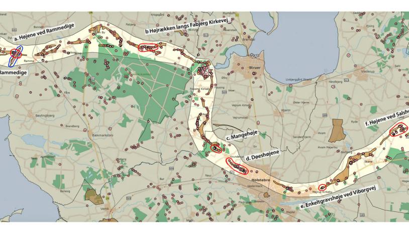
Photo:Søren Raarup
Connection Between the Geology and the Cultural Heritage
There are geological explanations for this. The morphological reason is that the landscape is relatively elevated with few crossing watercourses and marshy areas. The type of soil near the MSL is also significant. Here the soil is dominantly light and fertile, consisting of a mixture of sand and clay. The barrows, and therefore the areas inhabited in the Younger Stone Age and Bronze Age, are found exactly in the narrow belt between the clay-rich till landscape and the sandy outwash plain. These soil conditions were ideal for the farming people that settled here some 5000 years ago. The soil was fertile and yet light enough that it could be ploughed with the equipment available at that time. It is noteworthy that no significant Bronze Age finds have been made in the clay-rich, heavier soil of the moraine landscape behind the MSL. The narrow belt of land between the moraine landscape and the outwash plain was, until the land reforms in about 1800, intensively cultivated. This is in contrast to the dead ice landscape to the north and the heathlands of the outwash plain to the south.
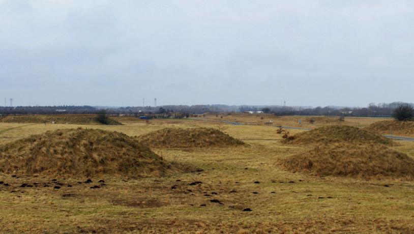
Photo:Søren Raarup
Single-grave Culture
Heathlands in west Jutland spread in the Single-Grave Culture (New Stone Age), presumably as a result of the removal of forests and controlled burning. The practice of cultivating heathland with frequent burning is known from the Single-Grave Culture period when these areas were presumably used for grazing. The few Bronze Age areas of habitation that have been found are located just north of the row of barrows and therefore north of the terminal moraine of the MSL. Many farms were located here until the land reforms in about 1800. This is most obvious in the Lomborg-Ramme interval.
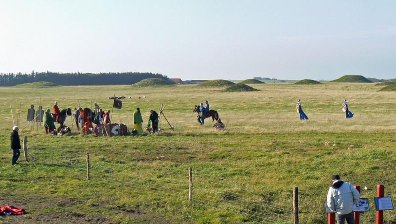
Photo:Lemvig Kommune
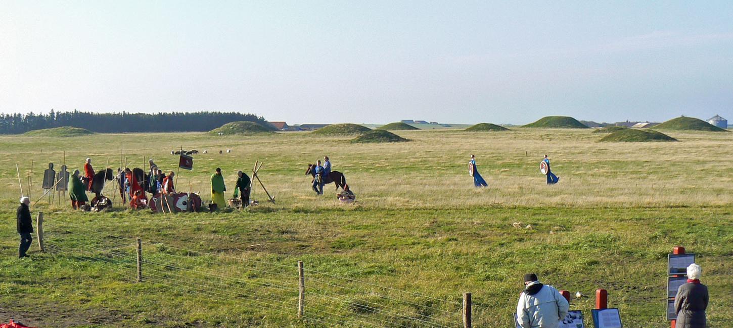
Barrows Along the Ancient Road
The Ancient Road is located in the area with the barrows. The sequence of barrows forms a corridor from the west coast to east of Viborg, a distance of almost 110 km. Today there is a total of about 560 preserved barrows and an additional 1300 that have been ploughed. Most of them were constructed in the Older Bronze Age (1700-1100 B.C.). The ancient road forms a marked corridor through Lemvig, Struer and Holstebro municipalities with a length here of about 65 km. There was presumably a landing site on the west coast when the road was built. During the Bronze Age there was considerable trade following routes at sea. An important raw material for the manufacture of bronze is tin (bronze consists of 90% copper and 10% tin). The main source of tin was Cornwall and Devon in SW England. There are numerous ships depicted in rock carvings in Scandinavia, and it seems very likely that there was a harbour on the west coast where amber could be traded for tin and noble metals, including gold.
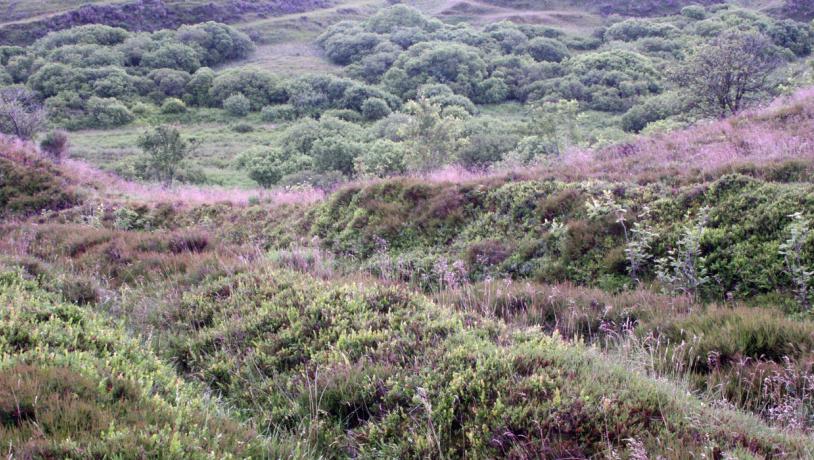
Photo:Mette Klingenberg
Elevated Barrows
Travellers could navigate using the elevated barrows and be led towards fords across watercourses in the otherwise relatively impassable landscape. The ancient road is therefore an important element of prehistoric infrastructure. Today it is only possible to follow the ancient road in a few places. After the land reforms in about 1800, field boundaries were changed and roads were moved. On old maps it is clear that the route of the ancient road was followed by roads along the row of barrows. Some of these stretches are local roads in the area today.