Stubber Kloster
Historical ruin of a former monastery belonging to the Order of Saint Benedict with a nearby example of an ancient livestock pen and traces of the Drovers’ Road.
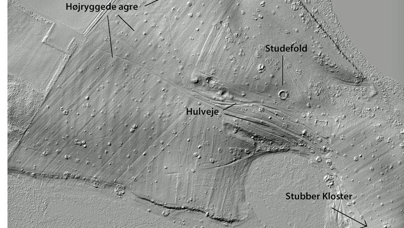
Photo:Søren Raarup
The Monastery
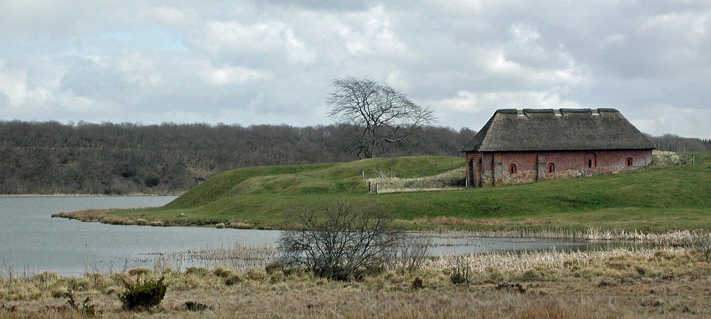
The remains of Stubber Kloster (Kloster means monastery) are located on a small peninsula on the west bank of Stubbergaard Lake. In Medieval times the monastery belonged to the Order of Saint Benedict. The precise age of the monastery is not known but it was mentioned as Claustrum Stubbetorp in a written source from 1268. After the Reformation in 1536 the monastery was taken over by the Crown and in 1538 it was given to the squire Iver Juel as an endowment. He converted the monastery into a manor house but the Benedictine nuns were allowed to stay on, and Iver Juel was obliged to provide for them for as long as they lived. The original four-wing monastery complex made of bricks has almost totally disappeared. Only the foundations of the northern part of the west wing have been preserved. This is probably where the cellars were located and the largest of the rooms that is still intact gives a good impression of the architecture of the medieval monastery.
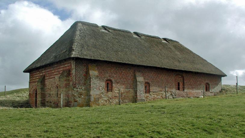
Photo:Holstebro Kommune
The original four-wing monastery complex made of bricks has almost totally disappeared. Only the foundations of the northern part of the west wing have been preserved. This is probably where the cellars were located and the largest of the rooms that is still intact gives a good impression of the architecture of the medieval monastery.
Photo:Søren Raarup
Near the old road leading past Stubbergaard Kloster east of Skave there is an ancient livestock pen that was used by Stubbergaard Kloster as a sheep’s pen. It is in a fenced off piece of land with meadows and heath and used for grazing. The pen is circular with a diameter of 14 m. It is surrounded by a 3 m wide and 0.3 – 0.8 m high bank which is highest in the west. The pen is covered in grass with a large oak tree in the middle.
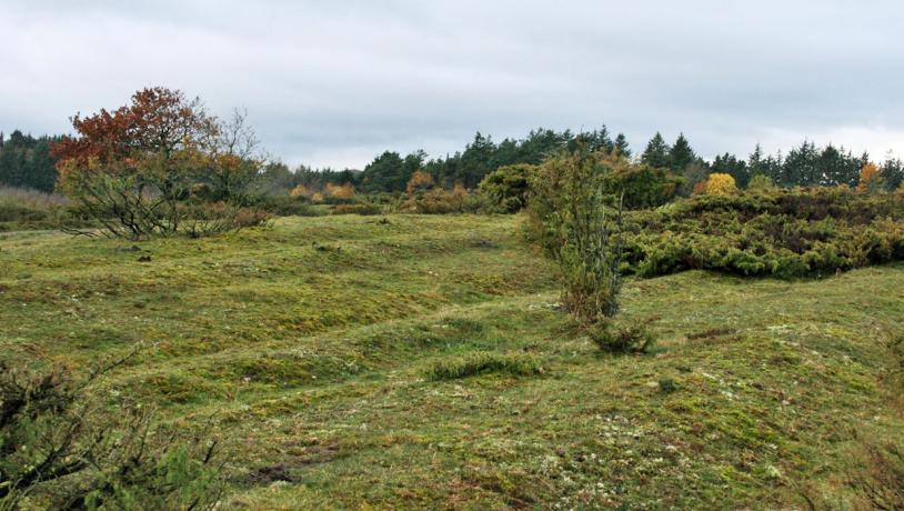
Photo:Søren Raarup
Livestock pens like this are known from other sites – typically along the old Drovers’ Road, where they were used for gathering the steers for the night. In the terrain surrounding the pen, traces of several ruts and gullies illustrate how the ancient routes were often corridors rather than proper roads. The many parallel tracks, which sometimes fan out, are clear evidence of how people were often forced to make a new rut when the old one had become too muddy and deep. Signs of ridges and furrows from the time of the wheel plough are revealed on digital elevation models. They accurately follow the fields and ploughing directions shown on old maps of land consolidation. The fields were abandoned and developed into heathland, probably in the middle 1800s.
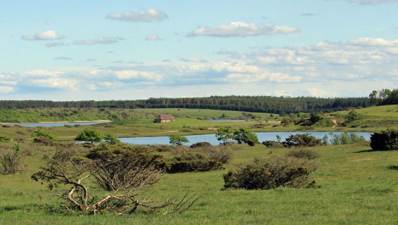
Photo:Søren Raarup
Relations to the Aspiring Geopark
The site has parking facilities and marked hiking trails in the surrounding area connecting to an extensive network of trails around Stubbergaard Sø and Flyndersø (Non-geological site N41 and Geosite no. 16).