Gjellerodde
Coastal landscape. Cuspate foreland.
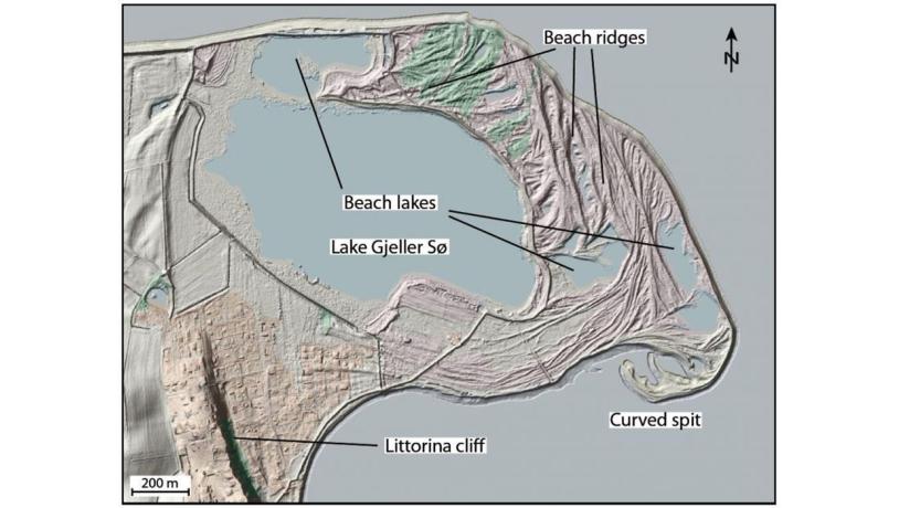
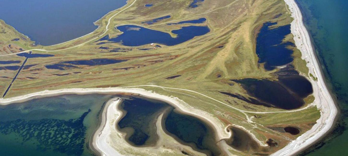
Figure 40-1: Gjellerodde.Photo:Geopark Vestjylland
Gjellerodde is a coastal area located north of Lemvig. It represents a good example of a cuspate foreland (see also site 41 Venø - Nørskov Vig) (Figure 40-1). It is likely that the area was a submarine shoal in the Littorina Sea (9.000-6.000 years ago). At that time the relative sea level was locally about 2 m higher than today and material eroded from the nearby coast formed a submarine shoal. The relative rise of the land in the area since the Littorina transgression has elevated the shoal and sand spits have developed from the west and south. The spits eventually merged and enclosed lake Gjeller Sø.
The area contains impressive examples of beach ridges that illustrate the gradual growth of the spits (Figure 40-2). There are several small lakes that have been enclosed by the advancing sand spits, of which lake Gjeller Sø is by far the largest. A recurved spit is presently developing in the extreme south-eastern corner of the area. This recurved spit is in the process of enclosing a new lake.
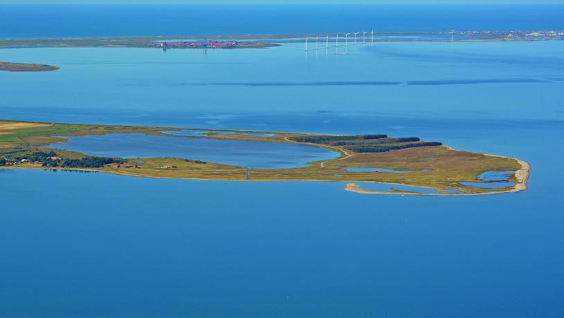
Photo:Lemvig.eu
Gjellerodde is a very illustrative example of spit formation and coastal deposition, resulting in the development of a cuspate foreland. It is therefore important that the coastal processes are not disturbed by human activities. The area is part of NGI 75 (area of National Geological Interest) and has been selected as a National Coastal Landscape. Gjellerodde has been selected as a Natura 2000 site and a Ramsar area. The south-eastern corner has been designated as a Natura 2000 habitat site. Most of the area consists of protected nature in the form of heaths, tidal meadows and bogs.
Nature management takes place by controlled burning and sheep grazing. The area is easily accessible and is a favoured tourist destination. It would be a good location to communicate geopark information.