Idom Å and Ormstrup Hede
River valley. Open heathland on a hill island.
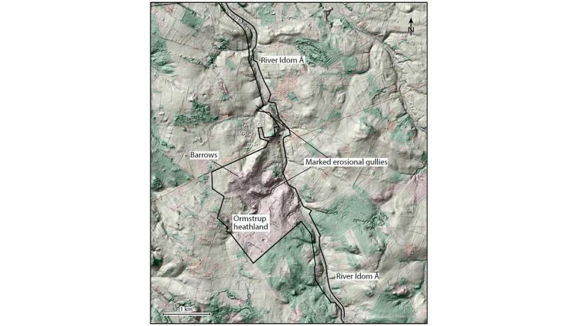
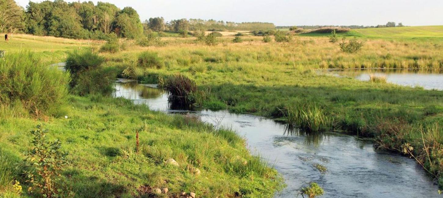
Figure 35-1: Idom Å and Ormstrup Hede.Photo:Geopark Vestjylland
River Idom Å and Ormstrup Hede heathland are located between Holstebro and Ulfborg. The area lies on the northern flank of Skovbjerg hill island where the Idom river is one of several tributaries to river Storå (see site 21 – The Storå Valley) (Figure 35-1). Ormstrup Hede is part of a large plantation, Stråsø Plantage, which is owned and administered by the Danish Nature Agency. Together with other heathland areas on Skovbjerg hill island (see, for example, site 34 - Sønder Vosborg Hede), Ormstrup Hede constitutes open areas where the landscapes typical of hill islands can be seen.
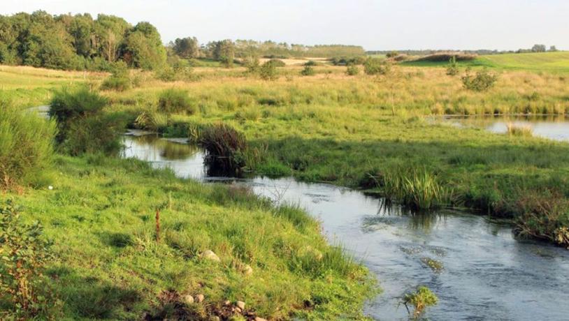
Photo:Søren Raarup
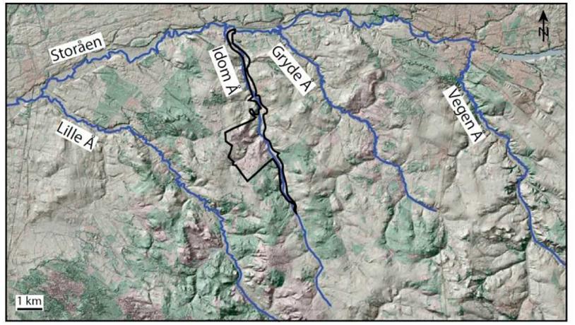
The Idom river follows a straight NNW-SSE course in a fairly deep valley. A feature of the northern flank of Skovbjerg hill island is that the small rivers have the same orientation. Rivers Lille Å, Idom Å, Gryde Å and Vegen Å are all roughly parallel and flow from southeast to northwest, as does river Storå east of Holstebro. The reason for this is not entirely clear, but the orientation may be controlled by subsurface structures. An alternative explanation is that the rivers were established during a period (e.g. during a glacial advance) when the terrain sloped in a different direction from today because of isostatic influence.
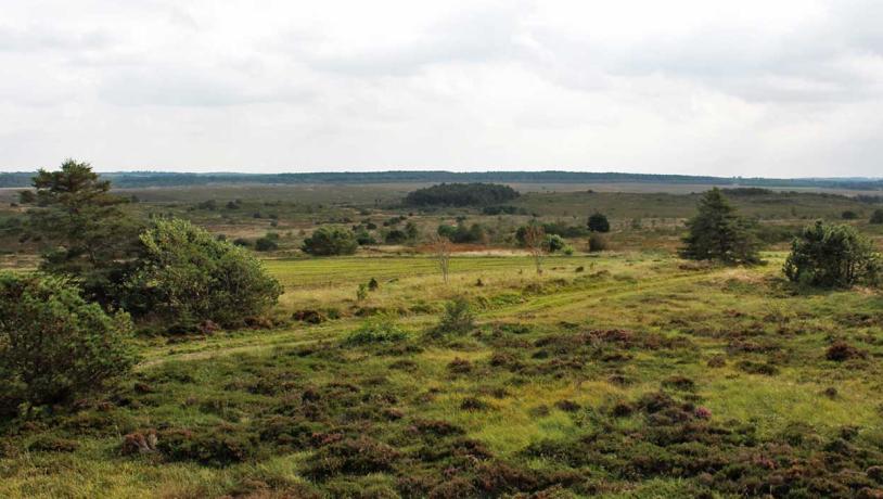
Photo:Geopark Vestjylland
While the Idom valley is straight, the detailed course of the river winds quite a lot and there are several impressive meanders. The courses of most rivers in Denmark have been channelised, and rivers that retain their natural courses are few and far between. The valley has not been drained or cultivated and consists of meadow and marshy areas with a high natural value (Figure 35-2). There are several erosional gullies along the Idom river valley, some of which are occupied by small streams.
The river Idom Å follows a courset hat is roughly parallel with several other rivers in the area.Photo:Geopark Vestjylland
Ormstrup Hede is an open area that gives a good impression of the landscape on Skovbjerg hill island (Figure 35-3). In the periglacial environment that affected the area during the Weichselian glaciation the landscape was modified and “flattened out” by soil creep. The area has also been subjected to erosion by running water which has resulted in several deep gullies.
The geological significance of the area is the presence of open stretches where both hill island and river valley landscapes can be appreciated. Idom Å valley and Ormstrup Hede heathland are included in National Geological Interest area NGI 77 (Skovbjerg Bakkeø), and both the valley and the heathland have been listed as Natura 2000 site. The entire area has been preserved to keep the landscapes intact and to ensure that it is accessible as a scientific reference site.
Ormstrup Hede and adjacent areas contain a large concentration of barrows (about 20). Parking facilities are provided and there are marked paths. It is important that the area is kept free of invasive plants so that the form of the landscape is clearly visible. The Danish Nature Agency maintains the area by felling trees, cutting grass, providing fencing and grazing.