Møborg Bavnehøj
Møborg Bavnehøj (beacon) is one of many high points in Geopark West Jutland from where there is an excellent view of the surrounding landscape.
The beacon is a good example of how the formation of the landscape and cultural history are connected, and how communication can be carried out in cooperation with local volunteers.
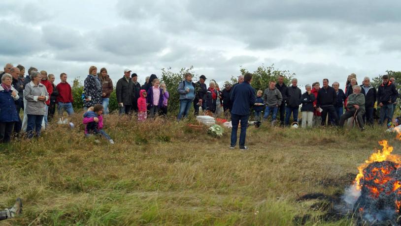
Photo:Møborg Sogneforening
The Beacon
The summit of Møborg Bavnehøj is 45 m above sea level and provides a splendid view of the surroundings. Beacons in Denmark are known from back to Viking times and were used as signals in the case of approaching danger until the Slesvik War in 1848-50. The worn “bavn” means a pile of wood that can be ignited to form a signal. In modern times the beacons are sometimes used for special celebrations. One of the 330 triangulation points in Denmark is located on the top of Møborg Bavnehøj. Most of them, including the one here, are made of granite fixed to a cement foundation. There is a brass plate on top of the granite pedestal that identifies the exact location of the triangulation point. These triangulation points were established when the whole of Denmark was mapped in the period between the 1830s and 1930s. Granite pedestals like that at Møborg Bavnehøj are some of the older examples.
Relationship to the Surrounding Landscape
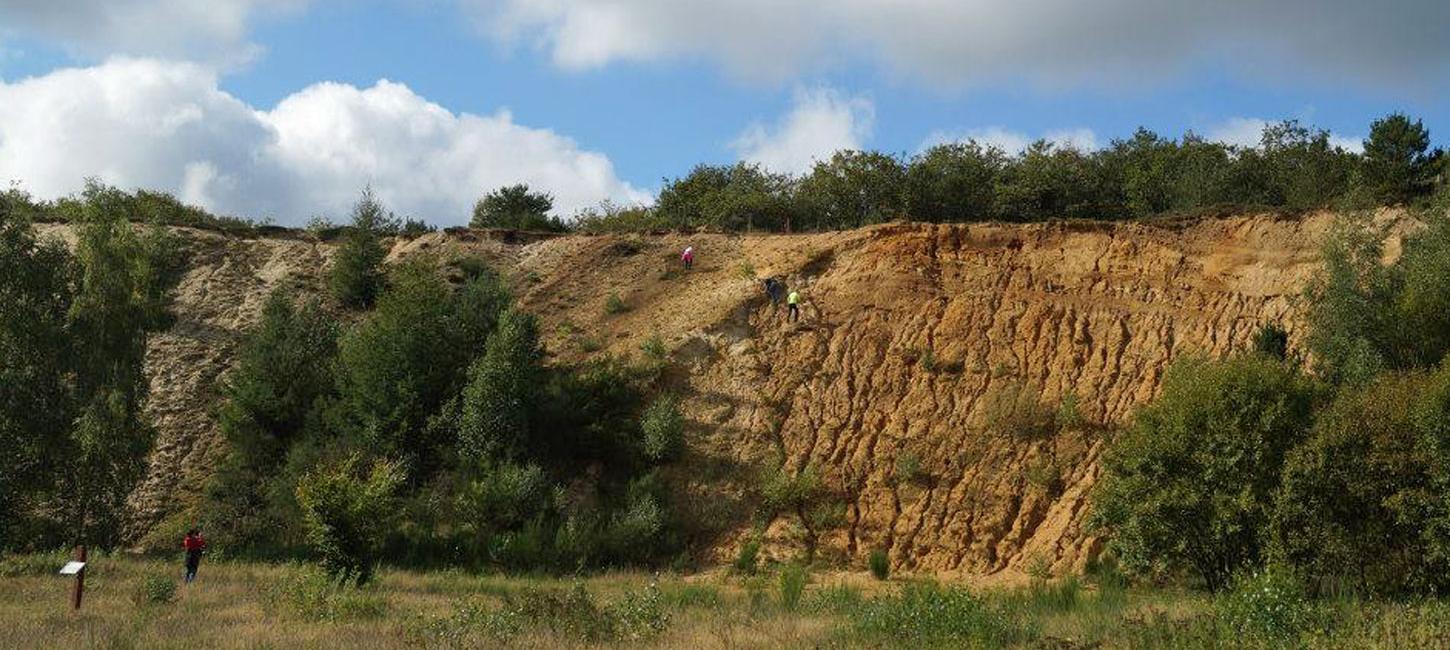
Møborg Bavnehøj and the church that is situated nearby, together with the many barrows on Møborg hill island, bear witness to how people settled here from an early date and illustrate how the landscape played an important role for the choice of a place to live. The nearby sandpit shows how glacial deposits have provided the possibility to carry out a commercial activity from the late 1940s until 1992.

Photo:Møborg Sogneforening
Traces in the Landscape
Bavnehøjen is a starting point for a new system of paths that has been established by a group of local volunteers in cooperation with Geopark West Jutland with support from the organization “Traces in the Landscape”. The path system links together the history of the landscape, the church and the local nature. It also draws attention to how nature has evolved over a very long period from the stage when it was an open, bare, windswept hill island until today with oak scrub, woodland, heathland, fields with hedges, and small lakes. There is a rich wildlife in the area with many common species. Unusual plants include club moss that belongs to a family of plants that can be traced back some 400 million years! In cooperation with the Danish Nature Agency who owns much of the area, the local parish society has established a shelter, toilet and barbeque facilities together with informative posters.
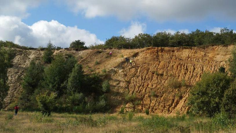
Photo:Geopark Vestjylland
Cooperation With the Aspiring Geopark
Møborg parish society and Geopark West Jutland have made an agreement that includes the establishment of “Traces in the Landscape” at Møborg Bavnehøj and the sandpit. The cooperation places the geological and archaeological features in a broader context. In recent years this locality has played a role in arrangements under “Geologiens Dage” (Geological Days).