Lem Vig
Tunnel valley with outwash fan deposits.
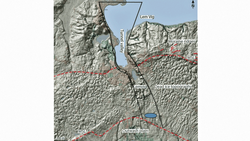
Photo:Geopark Vestjylland
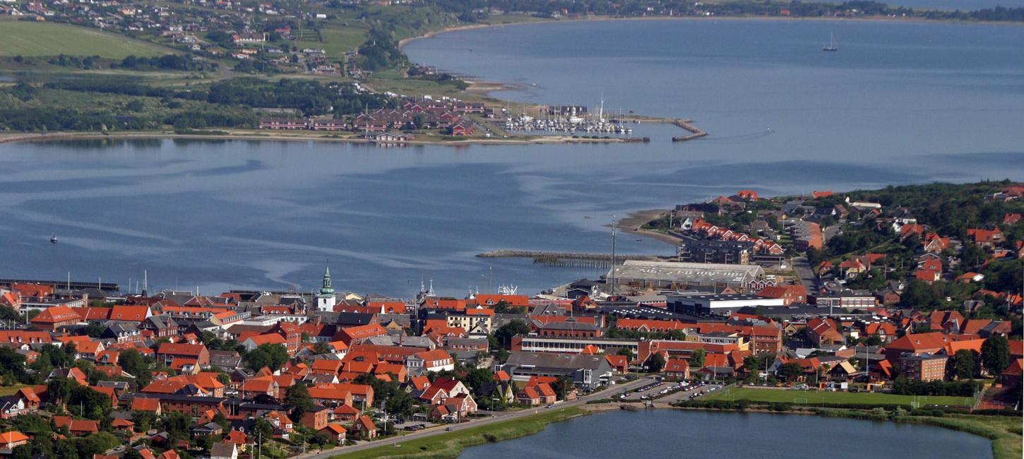
This locality comprises a broad valley with steep sides and includes that part of Limfjord (inland sea) which coincides with Lem Vig (bay). To the south it continues to Lemvig lake and further south it flattens out and the steep sides disappear at Roesgårde (Figure 13-1). From north to south the valley floor rises from sea level to about 40 m above sea level.
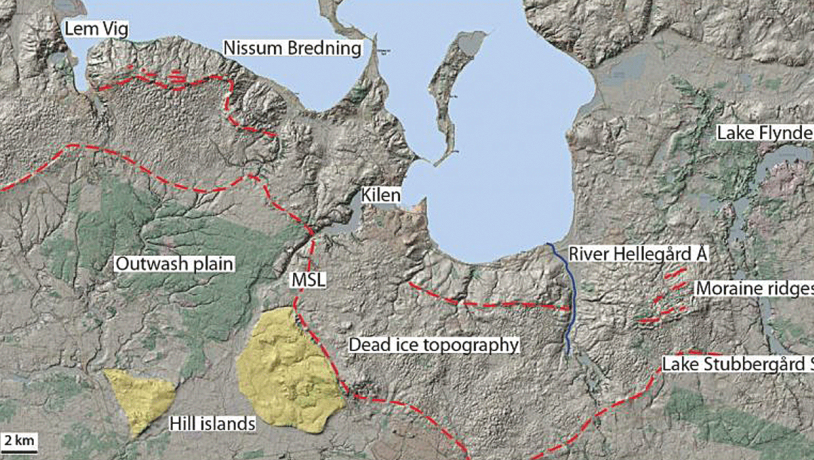
Photo:Geopark Vestjylland
This marked valley is one of the key localities in GPWJ and is interpreted as a tunnel valley formed by subglacial meltwater erosion. The valley was excavated by meltwater erosion in a subglacial channel that gradually carved its way deep into the substratum. The large volumes of meltwater exited the glacier portal at the ice front and formed a fan-shaped outwash plain in front of the melting ice. This valley developed when the glaciers reached their maximum extent during the Late Weichselian about 23.000-21.000 years ago, and is closely related to the MSL that is another key element in GPWJ. There are four tunnel valley localities in the geopark, each of which has its own special features (Figure 13-2).
At Lem Vig a special feature is the sea-covered entrance in the north to one of Denmark´s most impressive tunnel valleys that extends to Kronheden heath near Rom town. The valley has a maximum breadth of about 1 km and the valley sides slope locally more than 30°. This is the type example of a fjord landscape that developed in a tunnel valley. It is one of Denmark´s best examples of a classic tunnel valley since it has all the characteristic features within a relatively small area. The tunnel valley can be observed along its entire extent. It has steep, parallel valley sides and an uneven basal profile, with a threshold at Lemvig town, extending south to the lake and thereafter the steep rise up to the outwash deposits (Figure 13-3).
Photo:Benny Vejlby
The tunnel valley ends with a characteristic fan-shaped area of outwash deposits, the top point of which is at the location of the previous glacier portal. The outwash plain dips gently to the south and underlies Kronhede plantation. Further south and east this outwash plain merges with that formed by Kilen Tunnel Valley (site 14). Together they form an extensive surface that dips gently to the southwest towards Nissum Fjord and the North Sea.
The north-south valley from Lem Vig to the plain at Kronhede was interpreted as a tunnel valley in the early 1900´s, together with many similar valleys that strike normal to the MSL in central Jutland, by the Danish geologist N. V. Ussing (1864 - 1911). He referred to them as “fjord valleys”, a term which was changed to “tunnel valley” by another Danish geologist, V. Madsen. Ussing based his theory on the orientation of many valleys in eastern Jutland that are at right angles to the MSL and end at the top point of fan-shaped deposits at the former location of a glacier portal. From here meltwater spread out and laid down deposits in a fan-shaped area over an outwash plain south or west of the MSL. Ussing considered that the frequent occurrence of the top point of fan-shaped deposits at the end of a valley at right angles to the MSL could not be a coincidence. Another of Ussing´s arguments was that the uneven nature of the long profile of the valleys could not have been produced by a normal stream or river.
Today tunnel valleys, that commonly include a series of lakes, are still interpreted as having been excavated by subglacial streams. The water pressure was sufficient to force the water to flow up hill and out to the outwash plain where its load of sand and gravel was deposited to build a large fan-shaped outwash plain. The detailed dynamics involved in the formation of tunnel valleys are still a topic of discussion among geologists and can be expected to be more complex than outlined here and involve more morphological types. The tunnel valleys in Jutland will therefore continue to be of interest to Quaternary geologists.