30. Sønder Lem Vig - Geddal Enge
Marine foreland. Littorina cliff.
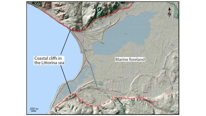
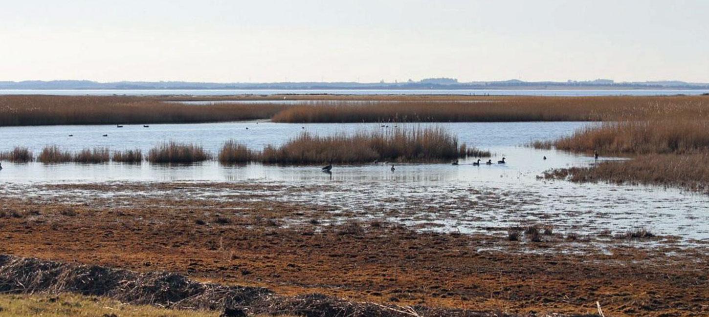
Figure 30-1: Sønder Lem Vig – Geddal Enge.Photo:Geopark Vestjylland
The Sønder Lem Vig – Geddal Enge area is located on the Limfjord coast north of Vinderup. It lies on the boundary between Holstebro and Skive municipalities, but it is only the part located in Holstebro municipality that is described here. The area comprises a shallow lake, Sønder Lem Vig, with adjacent marshy areas and a coastline with tidal meadows. To the south, the area is limited by a marked slope which rises up to 20 m above the surrounding area (Figure 30-1). The low-lying area represents a marine foreland, and the slope is a coastal cliff from the Littorina Sea (Figure 30-2).
The area was a meltwater valley during retreat of the Weichselian ice from its maximum position (see site 16 - Stubbergård Sø – Flyndersø). As at site 29 (Veserne-Engbjerg-Plet) the landscape was affected by changes in sea level after the melting of the Weichselian ice. In the Atlantic period (9.000 – 6.000 years ago), low-lying areas were flooded by the Littorina Sea as the sea level was about 2 m higher than today.
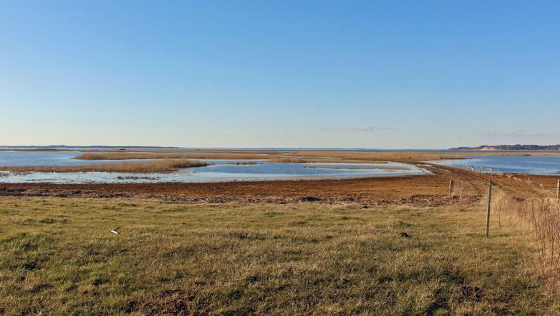
Photo:Torben Høj
Until about 150 years ago, Sønder Lem Vig was a shallow bay whose connection to Limfjord was partly restricted by spits and small islands. A dam was built in the 1870s that separated the bay from Limfjord. Drainage and subsequent cultivation were, however, never achieved, apart from small areas. A nature restoration project was carried out in the area in 1992 and today there are about 1000 ha of tidal meadows, reed marshes and shallow lakes. It has been selected as a Natura 2000 habitat site. There is a system of paths in the area and a walking trip brochure prepared by the municipality and local volunteers.