14. Kilen - Hornet
Winding Tunnel Valley between Venø Bugt and Klosterheden.
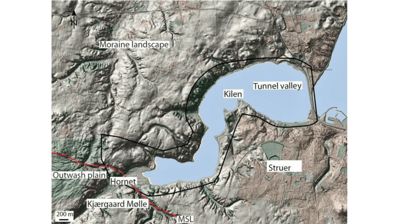
Figure 14-1: Map of the Kilen – Hornet area digital elevation model of the area. Photo:Geopark Vestjylland
This locality comprises a marked element of the landscape with a dammed fjord arm and its extension to a valley. The locality extends over a length of about 4 km with a width of about 1.5 km where the valley curves from Struer town to the southwest (Figure 14-1). Kilen – Hornet is one of four good examples of tunnel valleys in GPWJ and illustrates the variation in form of these structures that developed under the glaciers that formed the MSL. This tunnel valley meets the MSL where it makes a break. To the west the MSL is orientated roughly east-west, but where it meets the tunnel valley it changes course to roughly north-south. This break probably represents the site where two glacier lobes met. The tunnel valley is situated precisely at this junction. The valley cuts down into the moraine landscape north of the MSL in a quite flat area with a height of 30-40 m above sea level. The course of the winding valley from east-west through north-south and back to east-west links the locality Venø Bugt (site 28) in the north with the valley Fousing Valley (site 23) and the heathland Klosterhede - Kronhede (site 20) in the south.
Kilen – Hornet is one of four good examples of tunnel valleys in GPWJ and illustrates the variation in form of these structures that developed under the glaciers that formed the MSL. This tunnel valley meets the MSL where it makes a break. To the west the MSL is orientated roughly east-west, but where it meets the tunnel valley it changes course to roughly north-south. This break probably represents the site where two glacier lobes met. The tunnel valley is situated precisely at this junction.
The tunnel valley incises steeply down into the surrounding flat landscape with a fall of 30-40 m over a distance of 200-300 m. The detailed course of the valley in the underwater section is partly hidden by younger marine sediments. It is, however, possible to make out a threshold in the middle of the north-south section of the valley. In the south the valley floor rises quite steeply up towards the MSL with a rise of about 40 m over a distance of less than 1 km. The tunnel valley ends in a characteristic fan consisting of meltwater deposits at Hornet. There is evidence of deposition from a braided river. The fan extends south to the valley Fousing Valley (site 23).
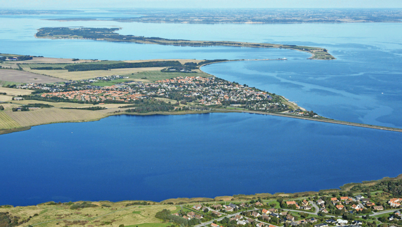
Figure 14-2:.Housing at the western end of Struer is visible in the foreground. Kilen and the dam. Venø Bugt together with Venø island. Venø sound is between Venø island and the mainland.Photo:Lemvig.eu
The tunnel valley therefore has several characteristic features but distinguishes itself from others by its winding course and its location at a 90° break in the MSL. Several marked V-shaped tributary valleys cut down into the landscape on either side of the tunnel valley. These were formed in late- and postglacial times by the erosive action of running water. The floor of the dammed fjord arm, and near-shore areas in Venø Bugt, is covered by postglacial marine deposits and the outmost part has been flooded by the sea (Figure 14-2).
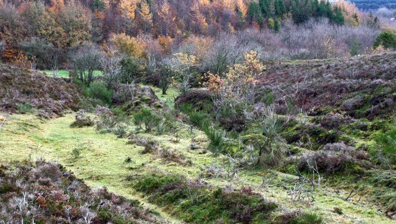
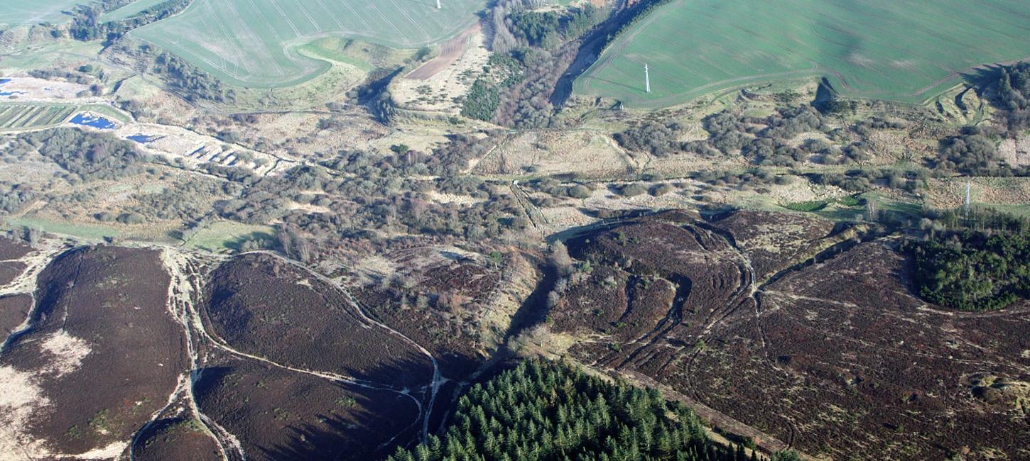
Figure 14-3: View across the heath towards a sunken road near Kjærgårdsmølle mill.Photo:Geopark Vestjylland
The area was conserved in 1980 to maintain and preserve the nature of the landscape. Barrows and traces of prehistoric roads are preserved (Figure 14-3). The presence of many barrows and the remains of old roads bear witness to this being an area important for traffic and settlement (see e.g. site 3 - Fabjergkirkevej). The mill at Kjærgaard Mølle was active from the Middle Ages until 1913 when a fire brought more than 500 years of production to an end. The area is a well-visited nature centre. The entire area has considerable recreational value with many marked paths. The Hornet area is covered by many kinds of deciduous trees and is one of the most varied wooded areas in the Klosterheden area.